
North Fish Creek, Phase 4 Fish Habitat Improvement Project
Bayfield Co., Wisconsin
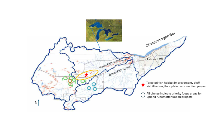
Figure 1. Location of North Fish Creek Phase 4 project area and proposed project activities.
Excess sedimentation is widely recognized as the largest nonpoint source of pollution threatening aquatic habitat and nearshore water quality in the Chequamegon Bay region of Bayfield County, Wisconsin. The Fish Creek watershed is the primary source of excess sedimentation directly to Chequamegon Bay, emanating from a series of large, eroding bluffs along the upper main stems of North and South Fish Creek, exposed by past land use/land cover changes and exacerbated by current land use, water drainage patterns, and a catastrophic flood and bridge failure in 2018. This sediment is the primary contributor to habitat degradation for brook trout and other fish and aquatic life in Fish Creek and downstream areas which contains important spawning habitat for northern pike and yellow perch. This project (Phase 4) leverages partnerships and experience gained from three previous phases of targeted fish habitat improvement, bluff stabilization, and upland runoff attenuation on North Fish Creek.
Phase 1 restoration involved a bluff stabilization project and upland runoff attenuation projects on North Fish Creek 2016-2018. Phase 2 and 3 projects focused on reducing in-stream sediment sources and improving in-stream fish habitat implemented in 2021-2025. To date, the five bluff stabilization projects (Phase 1-3) have reduced an estimated 10,600 U.S. tons of sediment loading/year to the stream, 66% of the long-term sediment reduction goal.
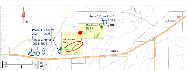
Figure 2. Map showing completed Phase 1-3 bluff stabilization and fish habitat enhancement project locations and proposed Phase 4 fish habitat improvement, bluff stabilization, and floodplain reconnection project locations.
Phase 4 will continue to enhance efforts to implement science-informed recommendations to reduce excess sedimentation and address issues resulting from historic flooding in Fish Creek, WI in 2018. The Phase 4 project will save an estimated 4,800 tons of sediment annually from entering the creek and ultimately Chequamegon Bay, Lake Superior and protect and enhance fish habitat along 1,400 feet of riparian corridor directly impacted by the project and over 16 miles of riparian corridor downstream to Lake Superior, and achieve the overall goal of reducing 16,000 tons of sediment input/year into Fish Creek. The project will also provide hydrologic modification aimed at reducing the erosive power of flood peaks via floodplain reconnection along approximately 3,400 feet of riparian corridor and by implementing agricultural runoff attenuation practices that will slow the flow of runoff from approximately 1,000 upland acres draining to erosional reaches of the stream channel. All elements of the proposed project directly address the LSC priority to address hydrological modifications that impact brook trout production on south shore tributaries in Wisconsin’s portion of Lake Superior.
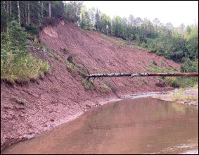
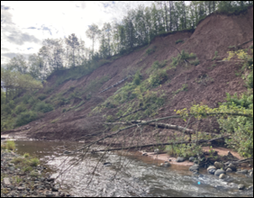
Figure 3. Two sites of North Fish Creek targeted for bluff stabilization as part of Phase 4 work.
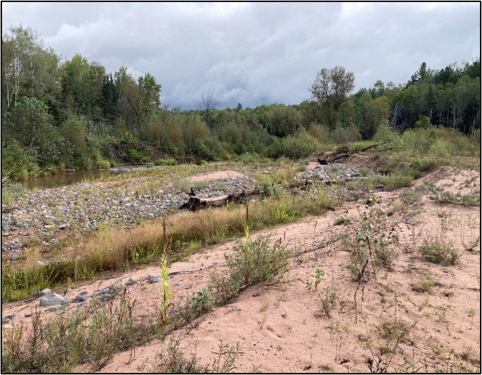
Figure 4. Area of North Fish Creek targeted for floodplain reconnection and fish habitat improvement as part of Phase 4 work.
Survey and design work for the bluff stabilization and floodplain reconnection occurred during fall and winter of FY26/27. Permitting and agreements will be secured in spring of FY27, with construction possible by the summer of FY27. Construction will be completed by the end of FY28. Landowner outreach for the upland work began summer of FY26 and will continue throughout FY26 and FY27. Construction will occur during summer of FY26-FY28.
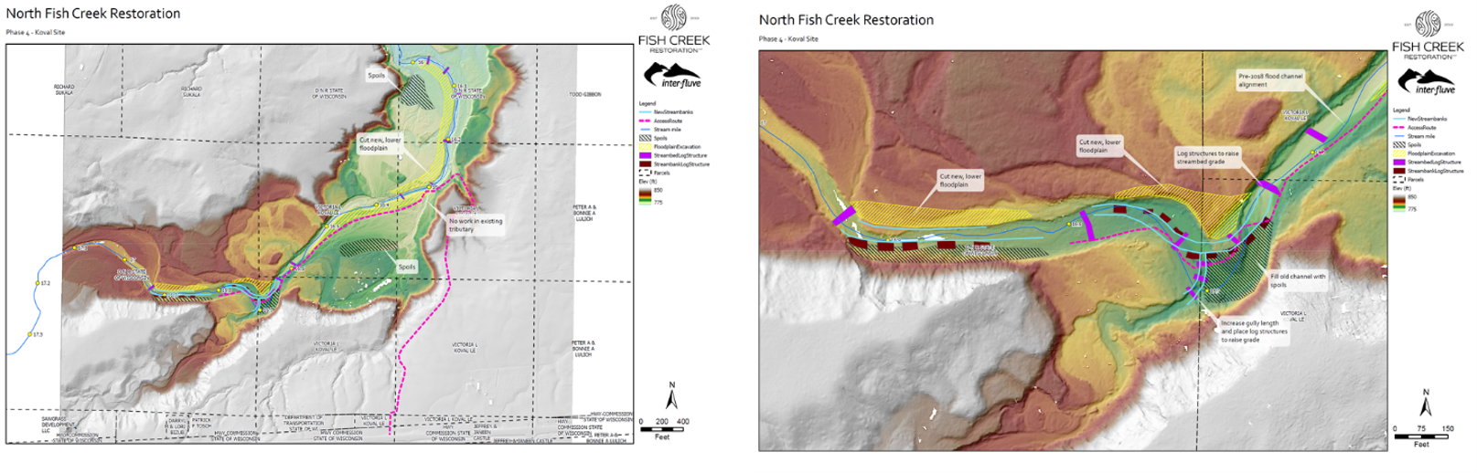
Figure 5. Conceptual Design Plans for Phase 4.
Burke Center for Watershed Research (BCER), had completed annual photo monitoring of Phase 1-3 projects to evaluate project performance over time and is in the process of identifying post-restoration monitoring activities that will evaluate project performance and inform future design strategies as part of this long-term, adaptive effort to reduce excess sedimentation and improve fish habitat in the Fish Creek watershed.
Project partners include BCER, GLFC, Bayfield County Land and Water Conservation District, US Forest Service, Chequamegon-Nicolet National Forest, Washburn District, and WDNR and will work with NOAA staff to develop project assessment and monitoring plans consistent with Tier 1 guidance and all data collection will adhere to the North Fish Creek Quality Assurance Project Plan.
The physical data pre- and post-construction will be stored internally by BCWR, WDNR, and the GLFC on this webpage. Contact Jeff Tyson for more information or to make a data request. All future sub-awardees not identified in this plan will have acceptance as a condition of their contract of this data sharing plan. Any additional data sharing stipulations for future sub-awardees may be outlined at that time and described in their contract.